|
.jpg)
|
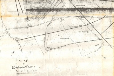
Map of the Coed-y-go Colliery (Savins Pit) with the start of the railway going south towards Gronwen.
Source Ken Owen |
|

|
View of the bridge on a post card of Woodhill. This bridge was built by Savin with a high arch, to accommodate the high chimneys of Savins engines. The original road went over a small hump back bridge nearer to the property which is now a nursing home and the owner of this property has just had the small bridge rebuilt.
Source Ken Owen |
|
|
Map of Woodhill lane showing the above restored bridge prior to Savin straightening the road and putting in his high arched bridge
Source Ken Owen |
|
.jpg)
|
Article in the Advertizer dated June 9th 1869 giving an account of the Coming-of-age party for George Dunville-Lees of the Woodhill Estate.describing the celebrations and guest attending including Thomas Savin. Mention is also made of the Mineral train passing the estate and letting off Fog Detonators on the way to Porthywaen.
Note that the date would have been close to when the line was lifted after Thomas Savin going bankrupt in 1866.
Source Border Counties Advertizer |
|
|
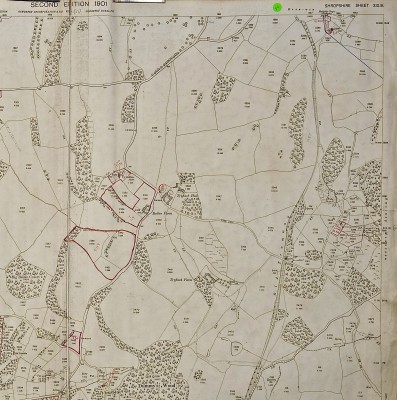
1901 map showing the track bed running north/south and crossing a narrow lane leading up to Treflach Hall. The cottage called Crossing Cottage was built by Savin,
Source Ken Owen |
|
|
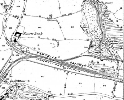
End of the 2 mile railway showing the Crossing cottage top left going over a small lane and curving south/east and joining the Cambrian Railway main line. Note that after joining the main line for a short ditance another spur came off to the north to serve lime kilns in the Dolgoch Quarry. Coal from Savins pit would have been taken to the top of the kilns as shown on the map. These kilns are still in the undergrowth which is now controlled by the Wildlife Trust.
Source Ken Owen |
|
|
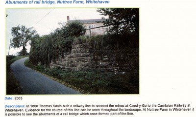
Photo of the abutment of the old bridge that carried the railway over Nuttree Lane. On the map above the railway leaves the bridge on a high embankment going towards the Main Line. This embankment is still there and not being used. (2017)
Source Ken Owen |
|
|
|
|
|
|
.jpg)


.jpg)


